


Voting District MH, Lenoir County, North Carolina
About
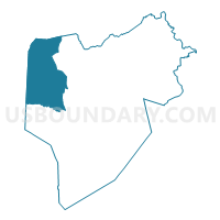
Outline

Summary
| Unique Area Identifier | 640598 |
| Name | Voting District MH |
| County | Lenoir County |
| State | North Carolina |
| Area (square miles) | 46.75 |
| Land Area (square miles) | 46.53 |
| Water Area (square miles) | 0.22 |
| % of Land Area | 99.53 |
| % of Water Area | 0.47 |
| Latitude of the Internal Point | 35.29323180 |
| Longtitude of the Internal Point | -77.78181910 |
Maps


Graphs
Select a template below for downloading or customizing gragh for Voting District MH, Lenoir County, North Carolina


Neighbors
Neighoring Voting District (by Name) Neighboring Voting District on the Map
- Voting District 15, Wayne County, NC
- Voting District ARBA, Greene County, NC
- Voting District FC, Lenoir County, NC
- Voting District I, Lenoir County, NC
- Voting District SHIN, Greene County, NC
- Voting District T2, Lenoir County, NC
Top 10 Neighboring County Subdivision (by Population) Neighboring County Subdivision on the Map
- New Hope township, Wayne County, NC (15,559)
- Saulston township, Wayne County, NC (7,676)
- Falling Creek township, Lenoir County, NC (5,979)
- Moseley Hall township, Lenoir County, NC (5,715)
- Trent township, Lenoir County, NC (3,527)
- Institute township, Lenoir County, NC (2,623)
- Jason township, Greene County, NC (1,868)
Top 10 Neighboring Place (by Population) Neighboring Place on the Map
Top 10 Neighboring Unified School District (by Population) Neighboring Unified School District on the Map
- Wayne County Public Schools, NC (122,623)
- Lenoir County Schools, NC (59,495)
- Greene County Schools, NC (21,362)
Top 10 Neighboring State Legislative District Lower Chamber (by Population) Neighboring State Legislative District Lower Chamber on the Map
Top 10 Neighboring State Legislative District Upper Chamber (by Population) Neighboring State Legislative District Upper Chamber on the Map
Top 10 Neighboring 111th Congressional District (by Population) Neighboring 111th Congressional District on the Map
Top 10 Neighboring Census Tract (by Population) Neighboring Census Tract on the Map
- Census Tract 112, Lenoir County, NC (6,682)
- Census Tract 3.02, Wayne County, NC (6,162)
- Census Tract 111, Lenoir County, NC (5,820)
- Census Tract 4.01, Wayne County, NC (5,253)
- Census Tract 9502, Greene County, NC (4,704)
- Census Tract 110.01, Lenoir County, NC (4,483)
- Census Tract 110.02, Lenoir County, NC (4,012)